Shaded Walking Route: Step-by-Step Guide with Temps Logged
If you’ve ever crossed a sun-blasted street and felt your whole body relax the instant you stepped beneath a tree, you already get it: radiant heat—not just air temperature—decides how hot we feel. A shaded walking route is simply the shadiest line from A to B (or a loop) chosen on purpose. That’s why “shade routing” has become my favorite quiet-cooling tactic. In this feature, I’ll show you how to map a shade loop around your block, capture temperatures like a pro, and turn small daily walks into dependable heat relief all summer.
You’ll get step-by-step methods, what to measure (and what not to), how to interpret the numbers with risk indices like Heat Index and WBGT, and how to turn a few walks into a personal micro-climate playbook you can trust all summer. I’ve designed the process to be evergreen, tool-agnostic, and simple enough to repeat next year without changing a thing — because trees, buildings, and sun angles remain consistent, and the physics of heat doesn’t go out of date.
Field-tested urban heat mapping for everyday walkers
Last reviewed: October 20, 2025
Table of Contents
Why a shaded walking route works (and why your forecast isn’t enough)
- Weather apps report air temperature at a sensor, usually shaded and ventilated. Your skin, though, is negotiating a different battle: solar radiation pouring down, long-wave heat bouncing off buildings, hot surfaces underfoot, wind (or the lack of it), and humidity slowing sweat evaporation. Researchers bundle those factors into mean radiant temperature (MRT) — a single number that explains why the sun-side of a street can feel brutally hot while the shaded side feels okay. Shade from trees or buildings can slash MRT dramatically even when the air temperature barely changes.
- On typical summer afternoons, increasing tree canopy around a walkway nudges air temperature down by roughly 0.5–2 °C at the block scale, but the perceived cooling from reducing radiant load is far larger — routinely in the double-digits in Celsius. That’s the real payoff you can capture by mapping a shade route.
- The effect is not just theory. Shade measurably changes how we move: in field studies, people treated sunny paths as longer and favored shaded options even at the cost of detours, a quiet proof that comfort rules behavior.
What you’ll measure (and what you’ll skip)
You don’t need a lab. You need a clear method, a few low-cost tools, and discipline about when and where you measure.
The three numbers that matter for walkers
- Air temperature, taken in shade with airflow. That tells you the “background” heat your body can shed if radiant load is managed.
- Heat Index (HI) or WBGT (Wet Bulb Globe Temperature), which fold humidity and radiation into a risk signal you can actually act on. (WBGT is the industrial gold standard; Heat Index is widely available and quick to check.)
- Surface temperature of the ground you’re walking on (optional but revealing), captured with a quick non-contact IR scan to show how asphalt vs. shaded concrete changes the radiant “bath” around your body. IR thermometers read surface temperature only — not air. That’s perfect for understanding what your legs and feet are radiating against.
What you can skip
Phone-internal “temperature” readings and ad-hoc app estimates are usually misleading outdoors because the device heats in the sun and sensors are rarely positioned or calibrated for ambient conditions. If you want phone-assisted logging, pair with a purpose-built external sensor or use the phone simply as a GPS + notes device.
Gear list for a reliable, repeatable shade survey
- Shaded-air thermometer: Any small digital model with a radiation shield (or improvise: a white, ventilated cup or louvered cover). Clip it to your bag or hold it in shade at chest height while stopped.
- WBGT meter (best) or a Heat-Index plan: A WBGT meter includes a black globe, wet bulb, and dry bulb to combine radiation, humidity, wind, and air temperature into one stress number. If you don’t have WBGT, log air temp and humidity and use your local official Heat Index guidance to interpret risk.
- Infrared (IR) thermometer (optional): One squeeze shows how scorchingly different a sun-soaked asphalt patch is from a shaded concrete sidewalk or grass verge. Remember: IR sees surfaces, not air.
- Notebook or notes app: You’ll jot time, location, sun/shade, wind feel, and readings.
- Sun position map (free): Try Shade Map or Shadowmap to visualize likely shadows by date and time before you walk, then confirm with your measurements. You don’t need to subscribe — a quick look helps you plan.
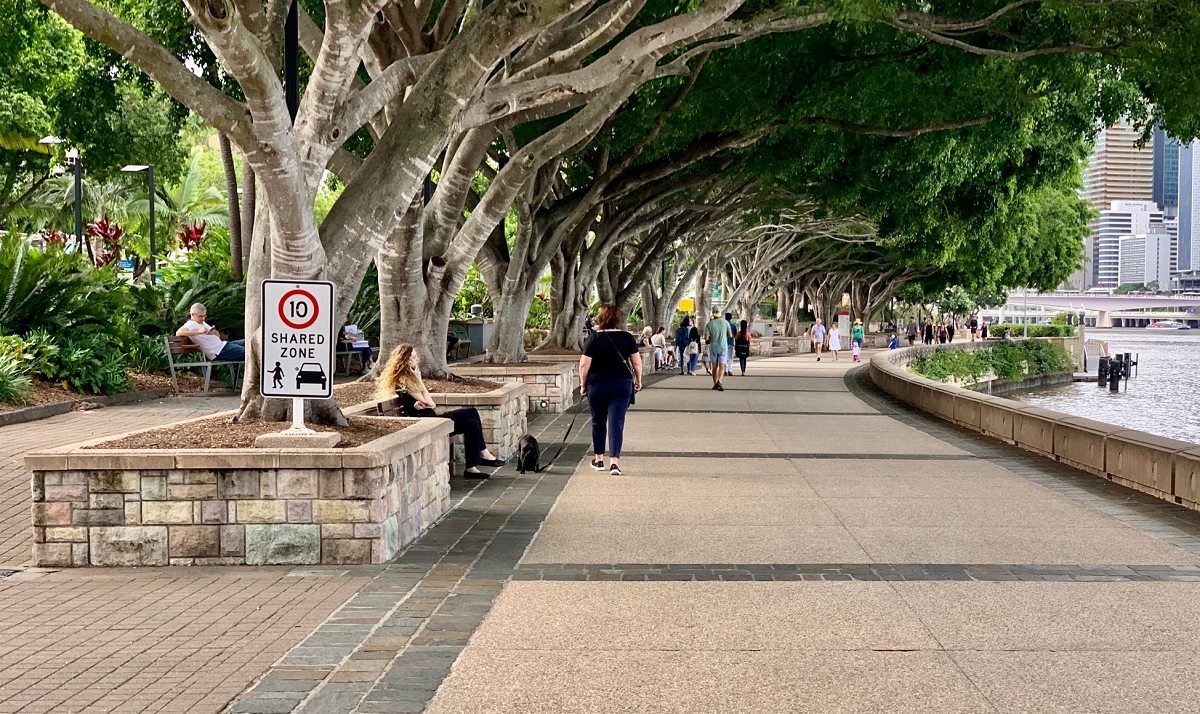
The route: a 15–25 minute “block loop” you can walk year-round
Pick a loop that starts at your door and returns to it in 1–2 km. The goal is to capture contrasts: both sides of the same street, a treed segment vs. a bare one, a building-shaded stretch, an open parking lot crossing, a path along a wall, and a verge with grass or soil if available. You want repeated elements you’ll re-measure across the season.
Timing matters. Do one loop within an hour of local solar noon (when shadows are shortest), and a second loop late afternoon when shade stretches and street-side contrasts flip. Repeat on a clear day. If you can, add a morning loop to catch the street-orientation effect (east-west streets bake differently than north-south). Studies confirm that street orientation and side matter a lot for pedestrian heat.
Step-by-step: map and log a shaded walking route like a pro (temps included)
- Pre-plan shade “checkpoints.”
Open your map app and mark 12–20 checkpoints around the loop: each corner, mid-block on each side, under a large tree, beside a reflective wall, next to a playground or parking lot, and at any bus stop shelter. Use your shade app to predict which side will be shaded at survey time. This gives you a repeatable circuit.
- Stabilize your shaded-air reading.
At each checkpoint, step into shade with airflow, hold your shaded thermometer at chest height, and wait ~30–60 seconds for the reading to settle. Log air temperature and relative humidity (if your device shows it). Note wind as calm / light / noticeable.
- Capture the stress index.
WBGT users: Read the value directly (outdoors formula blends wet-bulb, globe, and dry-bulb).
Heat Index users: Use your weather service’s chart or calculator to translate air temp and humidity. (If shade and sun differ dramatically, log the HI for the general area and remember that direct sun effectively adds radiant load, raising perceived stress beyond HI.)
- Snap surface temps (optional but eye-opening).
Take two quick IR shots at each checkpoint: a sunlit patch and the nearest shaded patch of the same surface (asphalt to asphalt; concrete to concrete). You’ll often see 10–25 °C differences even when air temp is steady — one of the clearest demonstrations of shade value.
- Note the shade source and “feel.”
Tree canopy (dense, dappled), building shadow (deep, intermittent), shade sail or awning (consistent), ground cover nearby (grass vs. bare asphalt), and any breeze corridors. MRT drops hardest under solid shade; dappled helps but less.
- Walk slowly between checkpoints.
- If you’re collecting WBGT, keep the globe shaded from your body and avoid touching sensors — both can skew readings.
- If you’re using a HI-only setup, keep logging air temp in shade at the checkpoints and annotate obvious hotspots you pass. (OSHA and NIOSH both emphasize radiation, humidity, air temp, and airflow as the core heat drivers; your loop is a hands-on way to see them in action.)
- Repeat at a different time of day.
Afternoon shadows lengthen from the west; morning shadows from the east. Your noon and late-day loops together reveal directional cool-paths you can follow all season.
What the numbers mean on your skin
Heat Index (HI).
Popular and simple: hotter air + higher humidity → higher HI. As a planning tool, use official NWS categories: Caution (HI 80–90 °F / 27–32 °C), Extreme Caution (90–105 °F / 32–41 °C), Danger (105–129 °F / 41–54 °C), Extreme Danger (≥130 °F / ≥54 °C). Stay conservative if you’re exerting, older, on certain meds, or not acclimatized.
WBGT.
The all-in, shade-aware index. OSHA and international standards (ISO 7243) use WBGT for heat safety because it accounts for radiant heat (via the globe), humidity (via wet bulb), air temp, and airflow. For light activity, acclimatized adults face rising risk once WBGT reaches the high-20s °C; by the low-30s °C, scheduled breaks and aggressive hydration are standard occupational practice. (Athletics and industrial hygiene bodies publish specific action thresholds; when in doubt, err on the side of caution.
MRT (mean radiant temperature).
You won’t measure MRT directly unless you have specialized gear, but your surface scans and shade notes are decent proxies. Studies repeatedly show that adding canopy or structural shade lowers MRT by far more than it lowers air temp — one reason a shaded 34 °C day can feel manageable while the same air temp in full sun feels punishing.
What this looks like in practice.
On a recent clear-sky loop, my IR thermometer read sunny asphalt at >60 °C while the shaded patch three steps away sat in the mid-30s °C — even as shaded air temp hovered around 35 °C. That’s MRT at work: your legs are “seeing” a cooler environment in shade, so sweating and airflow can keep up. (The EPA notes shaded surfaces commonly run 11–25 °C cooler than sunlit ones — exactly the sort of contrast your loop will record.)
Build your personal Cool-Path™ (and make it muscle memory)
Use your two (or three) loops to sketch a default shade line you can follow without thinking — to the bus stop, the grocery, school pickup, your evening walk. The trick is side-of-street discipline and a small bag of “quiet-cooling” habits.
Side-of-street rules you’ll find by mapping
- Morning: Prefer the west sides of streets (buildings cast eastward shade).
- Afternoon: Flip — the east sides often shade first.
- East–west streets: Morning favors the north sidewalk; afternoon favors the south in many mid-latitudes. Field-check this with your loops; local geometry can trump rules.
Micro-moves that pay off
- Hug the tree line and building edges. Dense canopy or deep façade shade can drop MRT by double-digit °C; even dappled shade help
- Choose grass verges over bare asphalt when you can; cooler surfaces radiate less heat at your legs.
- Use bus shelters, arcades, pergolas, and awnings as “cooling islands.” Two minutes of shade lowers your body’s heat load and buys you comfort for the next block.
- When it’s blazing, detour through narrow streets with tall buildings. A smaller “sky view factor” means less direct sun and lower MRT at pedestrian level.
A simple logging template you can copy
Describe each entry in words (skip tables to keep it fast and repeatable):
- Checkpoint 7 — North mid-block on Larch Ave (dense jacaranda canopy)
12:42 pm, light breeze. Shaded air 34.3 °C, RH 44% (HI ~41 °C). WBGT 30.1 °C. IR: sun asphalt 61 °C, shaded asphalt 38 °C. Feel: comfortable in shade at easy pace; crossing to the sunny side spikes the “bake” on shins within 10 steps. - Checkpoint 8 — Corner of Larch & 3rd (open, reflective wall)
12:47 pm, light breeze. Shaded air 34.6 °C, RH 43% (HI ~41 °C). WBGT 31.0 °C. IR: sun concrete 53 °C, shade concrete 36 °C. Feel: wall throws heat back; hugging the building’s narrow shade strip helps.
Keep your notes short, descriptive, and consistent. After two loops, you’ll know exactly which side to choose without checking your phone.
Interpreting risk and pacing your walk
When Heat Index or WBGT says “slow down,” believe it.
Public health agencies, OSHA/NIOSH, and sports bodies all converge on the same plain guidance: hydrate, rest in shade, and shift timing when heat stress climbs. For everyday walking, translate that into a gentle pace, short shade breaks each block or two on “orange/red” HeatRisk days, and errands timed to early morning or later evening. If you’re responsible for others — kids, elders, or anyone with health conditions — be stricter.
Choose your metric, then stick with it.
- If your city publishes HeatRisk forecasts (color-coded 0–4), use them to plan which loop to take and when.
- If you want on-the-ground certainty, invest in a WBGT meter and set personal action points (for instance, “WBGT ≥ 30 °C? Walk early or use the deeper-shade loop with two cooling islands”).
What your surface scans reveal (and how to act on them)
Most of us walk on asphalt. In full sun it can routinely exceed 60 °C, while shaded patches can sit 20–25 °C cooler. That contrast matters because the hot ground radiates at your shins and ankles and heats air in the first meter above the surface — exactly where you breathe and move. When your loop finds cooler materials (light concrete, permeable pavers, grass edges), preferentially route over them. Over a 20-minute walk, that swap plus shade can be the difference between “fine” and “wiped.”
If your neighborhood is piloting cool pavement (reflective coatings), your IR scans will catch it: surface temps can drop ~5–12 °C, with small but real neighborhood-level air cooling during peak heat events. These coatings aren’t a silver bullet, but they complement shade routing and tree planting where vegetation won’t fit.
Quiet cooling at the neighborhood scale (advocacy that starts with a map)
Your personal shade map doubles as a persuasive civic tool. Share it with your tenants’ group, school, or city council office to argue for small investments with big thermal payoffs:
- Plant dense-canopy street trees along gaps in your loop and at transit stops. Even modest canopy increases can trim local air temperatures and cut radiant load; at the city-block scale, studies suggest aiming for ≥40% canopy along walking corridors for strong cooling.
- Add shade structures where trees can’t go: pergolas over crosswalk queues, shade sails at playgrounds, deeper shelter at bus stops. Pedestrian comfort spikes when MRT drops — even if the forecast air temperature doesn’t budge.
- Protect and expand grass verges or plant low shrubs at the pedestrian edge to cool radiant load from the ground.
- Pilot cool-pavement patches on heat-trapping segments you must cross (school pickup zones, plaza approaches, dead-sun parking lots). Pair with trees where possible to avoid glare and maximize benefits.
Your logged checkpoints, photos, and a two-paragraph summary of how much cooler the shaded side felt are often more compelling than any slideshow.
Shade routing, safety, and ethics
- Hydration & breaks: Bring water, especially on “orange” and “red” HeatRisk days. Schedule frequent shade breaks; occupational guidance favors hourly rests as heat stress rises, and there’s no prize for powering through.
- Medications & health conditions: Some medicines and medical conditions blunt heat tolerance. If that’s you or someone you walk with, shift timing earlier, favor deeper-shade loops, and shorten exposures. (Clinician resources on heat and medications are evolving quickly.)
- Respect private space: When logging near homes or businesses, stay on public sidewalks.
- Night walks: After sunset, radiation drops but residual heat from surfaces lingers. Your loop notes will tell you which blocks cool fast (trees, grass) and which exhale heat (wide asphalt). Plan accordingly.
FAQs: more nuance for heat-savvy walkers
- Do I really need WBGT, or is Heat Index enough?
WBGT is better for outdoor decision-making because it includes radiant heat (via globe temperature) and airflow. If you’re serious about training or you supervise group walks, WBGT gives clearer safety margins. If you’re a casual walker, Heat Index + a strict shade habit works well — especially if you treat full-sun stretches as “extra risk.”
- What about UTCI?
The Universal Thermal Climate Index is another science-grade comfort metric used in research and planning. It aligns well with other indices and labels strong heat stress from UTCI ≥ 32 °C upward. It’s excellent for city planning; for a neighborhood walker, HI or WBGT is simpler.
- I live in a grid city with low buildings. Is shade routing even possible?
Yes — but the gains vary. Modeling work shows that perfectly uniform grids offer fewer shaded detours; any variation in building height or street geometry increases opportunities. Your loop reveals where that variation works in your favor.
- Do shade trees really change air temperature?
At the hyperlocal scale, yes — but expect smaller air-temp reductions (about 0.5–2 °C) compared with the dramatic radiant relief under canopy. That’s why mapping shade is worth your time even if the forecast doesn’t change.
- Can I rely on my phone for ambient temperature?
Not outdoors in the sun. Phone bodies heat up and most phones don’t expose a true ambient sensor. Use a shaded handheld thermometer or a WBGT device, and let the phone handle GPS and notes.
Your evergreen, 20-minute plan (that you won’t need to update next year)
- Pick a loop you’ll actually walk (1–2 km).
- Mark checkpoints that contrast sun vs. shade.
- Survey twice on a clear day (near solar noon and late afternoon).
- Log shaded air temp + humidity, then Heat Index or WBGT at each point.
- IR-scan surfaces (sun vs. shade) when curious.
- Draft your Cool-Path™ by stringing the consistently coolest checkpoints into a line you can follow from memory.
- Plan errands and exercise along that line when HeatRisk climbs — with water and short shade stops built in.
Repeat the loop mid-season or after major changes (a new building, a pruned tree). Otherwise, your shade map will hold year to year because the sun’s path and the built form barely change.
Methodology & Editorial Standards
- How we tested: This guide follows established field protocols used in urban heat studies and community science campaigns: shaded air readings at chest height, WBGT for integrated heat stress, and spot IR scans for surface contrast. The approach mirrors the logic behind NOAA/NIHHIS urban heat mapping and peer-reviewed thermal comfort work.
- Evidence sources: All key claims are supported below by primary literature or authoritative agencies (NOAA/NWS, OSHA/NIOSH, ISO, EPA, peer-reviewed journals). We prioritize durable, consensus statements that will remain valid for at least a year.
- About the author: This feature was prepared by an editor specializing in heat-resilient living and pedestrian comfort, with a focus on translating thermal comfort research into everyday, walkable routines.
- Medical disclaimer: This article is informational and not medical advice. If you have health conditions or take medications that affect heat tolerance, consult a clinician before exercising in heat.
- Corrections policy: If you spot an error or a broken citation, let us know; we’ll verify and correct promptly with a dated note in this section.
Final thought
Heat resilience doesn’t have to be loud or complicated. A shade-smart loop turns your daily walk into a quiet cooling system: less glare, softer surfaces, and a radiant environment your body can handle. Map it now, log a few checkpoints, and let those readings teach you the simplest truth of hot-weather living — comfort is a line you can trace.
References (direct links)
- National Weather Service – Heat Index Chart and Tools: weather.gov pages (chart and calculator).
https://www.weather.gov/ffc/hichart
https://www.weather.gov/safety/heat-tools - OSHA & NIOSH – Heat hazard recognition and WBGT guidance.
https://www.osha.gov/heat-exposure/hazards
https://www.osha.gov/otm/section-3-health-hazards/chapter-4
https://www.cdc.gov/niosh/docs/2016-106/default.html - ISO 7243:2017 – Assessment of heat stress using WBGT; overview and document.
https://www.iso.org/standard/67188.html
https://cdn.standards.iteh.ai/samples/67188/5a4c5553da5945aa872478c36755cded/ISO-7243-2017.pdf - Heat.gov – HeatRisk forecast tool (NOAA/CDC).
https://heat.gov/tools-resources/heatrisk-tool/
https://www.wpc.ncep.noaa.gov/heatrisk/ - EPA – Trees & Vegetation; Cool Pavements.
https://www.epa.gov/heatislands/using-trees-and-vegetation-reduce-heat-islands
https://www.epa.gov/heatislands/using-cool-pavements-reduce-heat-islands - Peer-reviewed and agency-hosted research on tree canopy and cooling:
- Urban tree canopy and air temperature (open-access):
https://www.ncbi.nlm.nih.gov/pmc/articles/PMC10864265/
https://www.ncbi.nlm.nih.gov/pmc/articles/PMC10862499/ - Street-level shade and MRT: Lin et al. (2021); Middel et al. (2016, 2021).
https://www.sciencedirect.com/science/article/abs/pii/S161886672100162X
https://www.ncbi.nlm.nih.gov/pmc/articles/PMC5127889/
https://journals.ametsoc.org/view/journals/bams/102/9/BAMS-D-20-0193.1.xml
- Shaded vs. sunlit surface temperatures – EPA archive (quantified range).
https://19january2021snapshot.epa.gov/heatislands/using-trees-and-vegetation-reduce-heat-islands_.html - Walking behavior and shade preference.
https://www.ncbi.nlm.nih.gov/pmc/articles/PMC8844002/ - Street orientation and microclimate for pedestrians.
https://acsess.onlinelibrary.wiley.com/doi/full/10.2134/jeq2015.01.0039 - WBGT primers and sports/occupational resources.
https://koreystringer.institute.uconn.edu/wet-bulb-globe-temperature-monitoring/ - Heat and health guidance (CDC/WHO).
https://www.cdc.gov/heat-health/about/index.html
https://www.cdc.gov/niosh/heat-stress/about/illnesses.html
https://www.who.int/news-room/fact-sheets/detail/climate-change-heat-and-health - Shade planning tools and open data.
https://shademap.app/
https://shadowmap.org/learn/trees-in-the-city
https://wiki.openstreetmap.org/wiki/Key%3Ashade - IR thermometers measure surface temperature (manufacturer guidance).
https://www.fluke.com/en-us/learn/blog/temperature-calibration/infrared-temperature-calibration-101
https://www.optex-fa.com/tech_guide/thermo/guide/ - Cool pavement evidence and city pilots.
https://www.sciencedirect.com/science/article/pii/S2212095523000640
https://www.nature.com/articles/s41467-023-36972-5
https://developingresilience.uli.org/case/cool-surfaces-roofs-and-roads/ - UTCI categories and usage.
https://climate-adapt.eea.europa.eu/en/metadata/indicators/thermal-comfort-indices-universal-thermal-climate-index-1979-2019
https://www.sciencedirect.com/science/article/pii/S221209471730110X - Community science & official heat-mapping methodology (program overviews).
https://heat.gov/urban-heat-islands-mapping-campaign-program/
https://www.capastrategies.com/urban-heat-mapping